"Condemned" protesters?! Who trapped Rama inside the Prime Minis...
/ 2026-10-23 16:02:00Focus


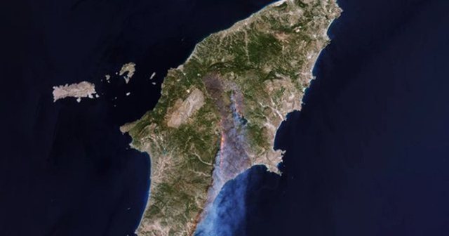
The extent of the destruction from the massive fire in Rhodes was captured by the European Sentinel-2 satellite used by the Copernicus program to record natural disasters.
In the European Space Agency (ESA) image taken on Sunday, July 23, the colors are natural with additional infrared image processing to show the front of the fire.
The burned area has a visible brown color. The smoke of the fires is very clearly visible, stretching to the south at a distance of tens of kilometers from the fronts.
The ESA estimate of the burned area is 110,000 hectares, at least at the time the picture was taken on Sunday. Following Greece's request, the Copernicus mechanism has been activated to assess the extent of the disaster, both in Rhodes and in other locations (Corfu, Karystos and Aigio).